


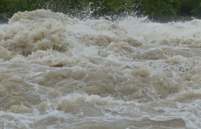
A High Streamflow Advisory has been issued for the South Coast as a series of storms is expected to bring prolonged rainfall and rising river levels across coastal British Columbia.

A High Streamflow Advisory means that river levels are rising or expected to rise rapidly, but that no major flooding is expected. Minor flooding in low-lying areas is possible, and fast-flowing rivers can pose serious safety hazards.
In an advisory, the BC River Forecast Centre said three-day rainfall totals of 60 to more than 200 millimetres are forecast, with the highest amounts expected over West Vancouver Island and higher terrain in the Howe Sound area and the North Shore Mountains. Freezing levels are expected to rise to between 1,500 and 2,000 metres, increasing runoff from snowmelt in areas where snow remains on the ground.
Local rivers are expected to experience high-flow episodes through Wednesday, Thursday, and Friday due to heavy rain and rain-on-snow conditions. Water levels may rise and fall during this period, but heightened awareness is advised as fast-moving water increases risks to public safety, the advisory noted.
Lake-fed river systems are expected to peak later, from Friday into Saturday, due to the cumulative effects of rainfall. Current modelling suggests river flows could reach levels typical of a two- to five-year event.
Residents are advised to stay safe around rivers and prepare for difficult driving conditions and potential road washouts, the advisory noted. Drivers are urged to check local conditions and avoid travelling through floodwaters or across damaged roads, as the BC River Forecast Centre continues to monitor the situation and provide updates as needed.
